 FIRESIGNAL by 1338
Live map › Corleone (IT)
Wildfire near Corleone (IT) · 1,199 ha - October 8, 2026
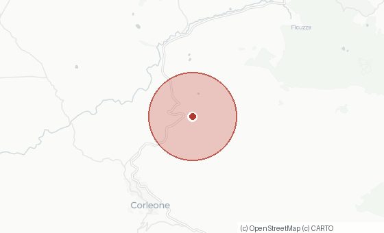
Satellites recorded a wildfire near Corleone (IT) from 08-10-2026 08:50 to 08-10-2026 08:50 (UTC). The measured heat zone covered roughly 1,199 ha (an upper bound based on pixel size, not an official fire perimeter). The event counted 2 satellite detections (MODIS).
Key figures
| First detection | 08-10-2026 08:50 UTC |
|---|---|
| Last detection | 08-10-2026 08:50 UTC |
| Coordinates | 37.8466, 13.3236 |
Surroundings
Nearest town: Corleone (IT), about 4 km. Larger town nearby: Palermo, about 30 km.
Observed by
This fire was seen by 1 satellite source(s): MODIS. Polar satellites deliver sharp measurements but pass over a few times a day; geostationary satellites watch continuously with a coarser pixel.
How these figures are produced
FireSignal groups individual satellite detections into a single fire event. The heat zone is the sum of the measured pixels and is therefore an upper bound: it says where heat was observed, not how many hectares actually burned. Official figures from fire services or authorities are usually lower. Cloud and thick smoke block the view, so there is always a gap between two observations.